By Cam Gordon
At-large Minneapolis Park and Recreation Board Commissioner, Tom Olsen, is a vocal supporter of the car-free option along Nicollet Ave. through the former Kmart site. “If the public works plan goes through, it’ll turn Eat Street into just another car sewer that hurts the community, business, and the environment,” he said. “Ultimately, we shouldn’t be creating streets which will encourage more car traffic, while we are in the middle of a climate crisis.”
The city has released a new set of recommendations for the redevelopment at Lake and Nicollet between Lake St. and Cecil Newman Lane. The city council is expected to review and approve a design later this month. The street was closed in the 1970s after the city of Minneapolis sold the 10-acre site to real estate investors, and it was converted into a shopping mall that was repurchased by the city and demolished last year.
The preferred street design, known as concept 1, has met with the most criticism. It dedicates space for two lanes of automobile traffic, as well as bus stopping and merging, parking, sidewalks, and green space. It does not have dedicated bike lanes. It was chosen over an option known as concept four that did not include car or truck traffic and would be open to transit and emergency vehicles only, similar to the Nicollet Mall downtown. Other vehicles, including passenger and freight vehicles would have continued to circulate around the site as they do now.
The street design follows the evaluation of four design concepts for the roadway that were presented last fall, and a series of events, interviews, and a survey. Both concept one and four were rated highly. The car-free concept four rated highest in the online surveys, but concept one was favored at in person meetings.
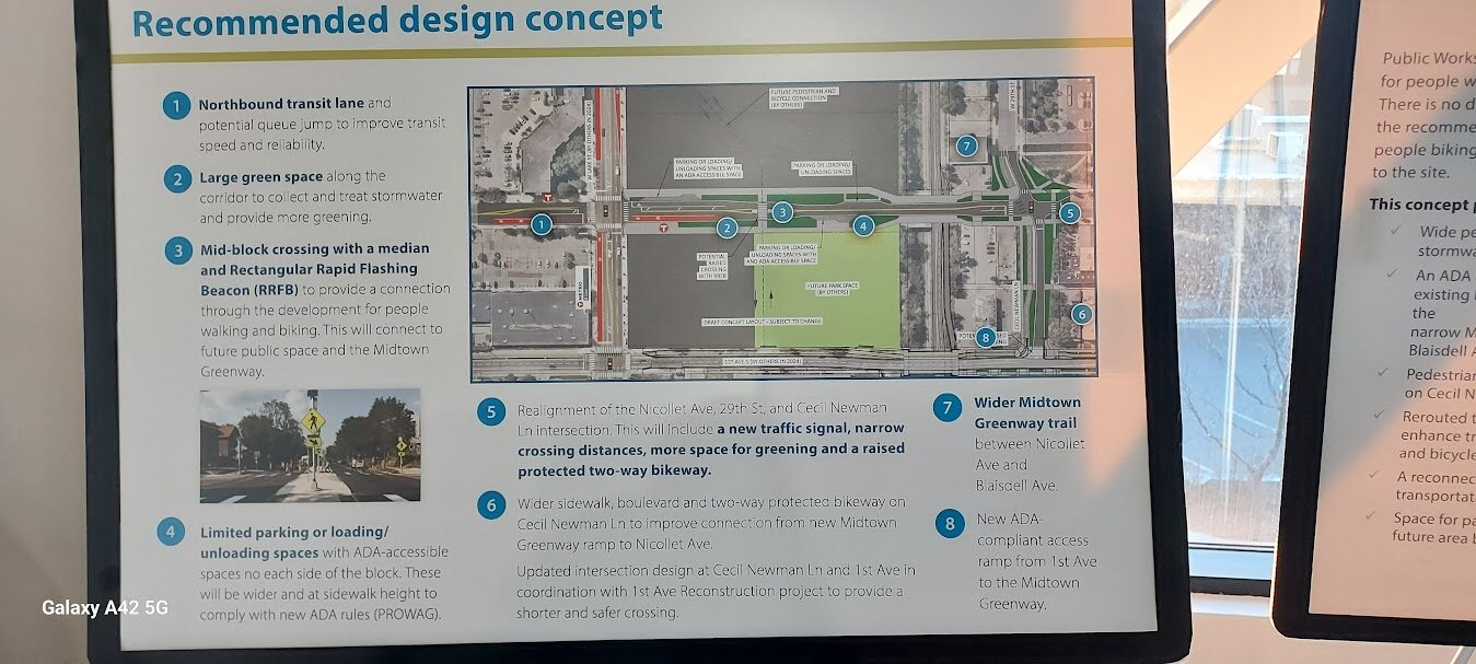
Recommended concept one has wide sidewalks, green space to manage treat stormwater, room for sidewalk cafes, parking or loading areas, a new accessible ramp to the Midtown Greenway, crossing improvements on Cecil Newman Lane and 29th St, and rerouted transit service to Nicollet.
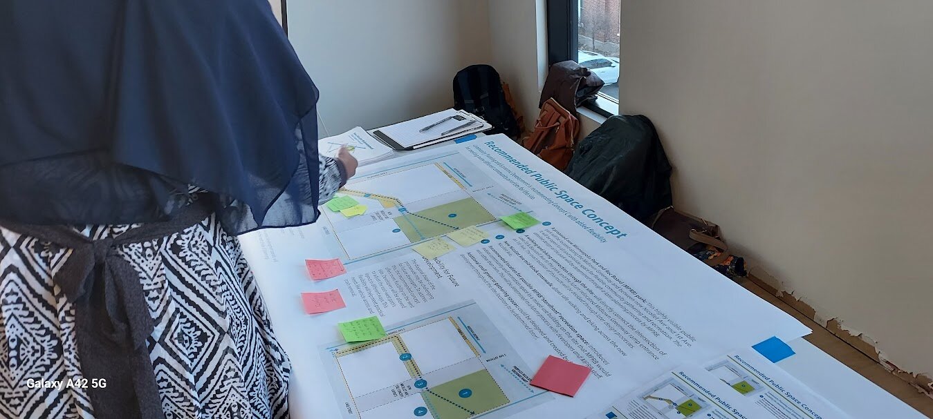
The public space framework has met with less criticism. It calls for a new park located along the Midtown Greenway between Nicollet and 1st Ave. that would be owned and operated by the Minneapolis Park and Recreation Board (MPRB) and provide space for gathering and recreation. The framework also includes a walking and biking connection through the site from Lake St. and Blaisdell Ave. to the park and to a relocated Midtown Greenway ramp entrance on 1st Ave. It also identifies a location for a “storefront” indoor recreation space in a mixed-use building on the site that MPRB would rent.
CITIZEN INPUT VARIES
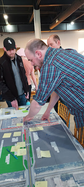
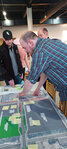
Natalie Wagner, a South Uptown resident, and member of the city’s bicycle advisory committee (BAC) attended a New Nicollet Redevelopment Project Open House on March 7 at the Abyssinia Cultural Center, at 322 W. Lake St.
“I was really hoping for the public space concept C, which was selected,” she said, speaking as a nearby neighbor and not representing the BAC which has reviewed but not taken a position on the recommendations. “However, I was very disappointed to learn that street concept one, which includes private vehicle thru traffic and street parking, along with transit and emergency vehicles, was selected over street concept four.”
Wagner is also concerned about traffic on Nicollet north of the site in the area known as Eat Street. “One of the reasons I have appreciated visiting Eat Street, as someone who drives infrequently, is because not having thru private vehicle traffic has meant lower speeds and has made biking on-street feel that little bit safer,” she said. “I am very concerned that allowing private vehicles and parking on-street, once Nicollet is opened across the Greenway, will make it much more dangerous to bike in the area because of increased vehicle speeds, will slow bus transportation and make it less reliable because of congestion caused by private vehicles passing through and visiting the area.”
“The impact of this project on the Eat Street corridor was a concern that came up frequently during community engagement,” said city staff. “The recommended concept preserves the feel of the Eat Street corridor while also encouraging traffic calming through the elimination of the center turn lane, addition of a mid-block crossing with a median island and widened pedestrian spaces.”
While Cecil Newman Lane and the route around the former Kmart site has been in place for many years, the staff also reported, “Eat Street business owners shared that many customers often have difficulty finding their businesses.”
Better bicycle connection to greenway
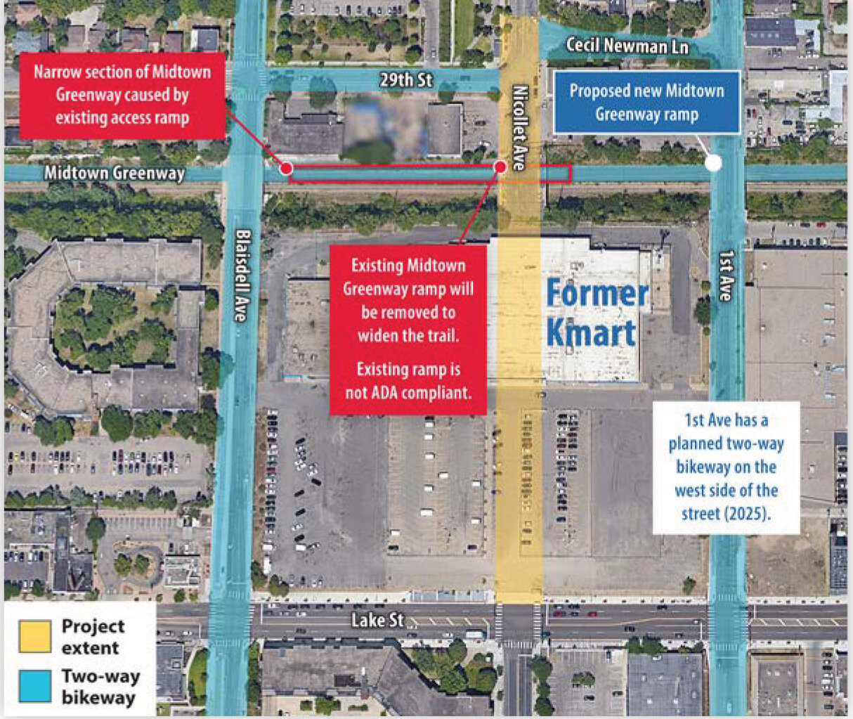
According to the staff report “the project team heard that people want the narrow trail section on the Midtown Greenway from Blaisdell Ave. to Nicollet Ave. widened. People also want a better bicycle connection to the Midtown Greenway via the city’s existing protected bike network on Blaisdell Ave. or 1st Ave.,” and so the new Greenway ramp will be moved one block east and will connect to 1st Ave. “to provide access between the trail and the project area.”
Kingfield resident, Aaron Shaffer, reviewed the staff report as another member of the BAC. “I think from the BAC perspective, people are really excited to see the 1st Ave. and Blaisdell dedicated bikeways,” he said. “I am very excited about the new ramp that will solve the accessibility problem and address the pinch point on the greenway.”
City staff also identified the ramp change as one reason for including car and truck traffic on the new stretch of Nicollet. “With concept four,” they concluded, “Cecil Newman Lane and 29th St. will carry higher volumes of traffic and be designed to accommodate large trucks turning across the new two-way bikeway at 1st Ave. immediately adjacent to the new Midtown Greenway ramp entrance.”
They also stated that if trucks continue to be routed around the site, it would require “larger intersections at 1st Ave., Cecil Newman, Nicollet Ave., 29th St. and Blaisdell Ave. to allow trucks to make the turns around the site,” and “pose a safety concern” for people walking and biking.
No curbside access for cars and trucks, longer trip lengths for people driving to access the area, maintaining a “confusing street network disconnecting a primary commercial corridor,” and longer queues with transit delays, were additional reasons given for why the car-free concept four was not chosen.
A city traffic study concluded that with a street open to all vehicles “operations for transit along Nicollet are expected to work much better, reducing delay for transit on Nicollet Ave. while supporting transit speed and reliability on Lake St. for the METRO B Line bus rapid transit line.”
Although Schaffer was pleased with parts of the recommendation, he was “super disappointed but not surprised that the preferred option included automobiles.”
He said, “This was a once in a lifetime opportunity to make transit faster than driving and make that a preferred option.” Instead, he worries that this will turn Nicollet into a commuter route. He “feels unsafe crossing Nicollet now” and with a straight connection from downtown to and from the streets connecting to the 35W freeway, like 31st, 35th and 46th, along the way, he expects it to get more frightening to use. “If it is open,” he added, “they need to do more traffic calming.”
“The city has multiple policies in place that are structured to prioritize walking, rolling, biking, and public transportation over infrastructure built to prioritize personal vehicles,” said Wagner. “It feels confusing and disingenuous that the city has selected a street concept that reintroduces thru car traffic and would bring higher volumes of private vehicle traffic through the area, to the detriment of safety and climate-conscious design goals.”
“We should not,” she added, “first establish policies prioritizing walking/rolling, biking, public transit, and freight and then subsequently make design choices that prioritize the default convenience of cars.”
Planning and community engagement for the larger development project will continue in the months ahead with construction of the new roadway and bridge over the greenway expected to begin in 2025.


Comments
No comments on this item Please log in to comment by clicking here